Pryor/Big Horn Mtns
Really wish my camera worked. Threw fresh batteries in yesterday and got a greenish purple pattern in the viewfinder. Snapped a few pics and they look same... :grayno: So no pictures (I don't even have a camera on my phone! )
)
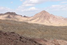
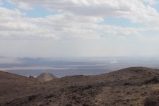
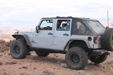
Anyway, spent 12 hours in the new 2015 JKURHR (Sunset Orange!) puttin' around NE of Big Horn Lake. It's actually the valley between the Pryor Mtns to the NW and the Big Horn Mtns to the ESE. It straddles the MT/WY border. The entire north side is Devil Canyon which is the drainage for Porcupine, Deer & Trout Creeks off the Big Horns. The canyon is pretty deep & spectacular and there are many amazing viewing locations along the south rim of the canyon. The views from up on the plateau are pretty amazing also.
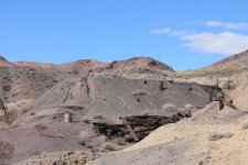
There are a few uranium mine sites up here. Also, Big Horn Cavern for you spelunker types.
Here's a picture to show a basic route plan. Hopefully it's not too hard to read. Not too familiar with Google Earth. What mapping software do you guys use to show routes? The Garmin GPS loaded up in my 2015 wasn't too terribly accurate in a few places.
Difficulty of the area prob maxes about 5 on a 10 scale. No big obstacles. Didn't even need the lockers or to disco the sway bar. Not too tough just steep going up to the plateau along the blue path which is not maintained. The primary path up/down the turquoise isn't too bad and is fairly well maintained. Can do most of this in 2WD. Can get crazy when it's wet though.
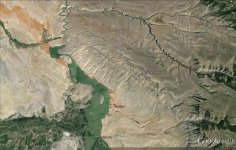
This is where my Jeep took me this weekend!
PS Didn't show the Pryor part of the trip...it's boring other than the views down Crooked Creek and since there are no pics, well...
Really wish my camera worked. Threw fresh batteries in yesterday and got a greenish purple pattern in the viewfinder. Snapped a few pics and they look same... :grayno: So no pictures (I don't even have a camera on my phone!
Anyway, spent 12 hours in the new 2015 JKURHR (Sunset Orange!) puttin' around NE of Big Horn Lake. It's actually the valley between the Pryor Mtns to the NW and the Big Horn Mtns to the ESE. It straddles the MT/WY border. The entire north side is Devil Canyon which is the drainage for Porcupine, Deer & Trout Creeks off the Big Horns. The canyon is pretty deep & spectacular and there are many amazing viewing locations along the south rim of the canyon. The views from up on the plateau are pretty amazing also.
There are a few uranium mine sites up here. Also, Big Horn Cavern for you spelunker types.
Here's a picture to show a basic route plan. Hopefully it's not too hard to read. Not too familiar with Google Earth. What mapping software do you guys use to show routes? The Garmin GPS loaded up in my 2015 wasn't too terribly accurate in a few places.
Difficulty of the area prob maxes about 5 on a 10 scale. No big obstacles. Didn't even need the lockers or to disco the sway bar. Not too tough just steep going up to the plateau along the blue path which is not maintained. The primary path up/down the turquoise isn't too bad and is fairly well maintained. Can do most of this in 2WD. Can get crazy when it's wet though.

This is where my Jeep took me this weekend!
PS Didn't show the Pryor part of the trip...it's boring other than the views down Crooked Creek and since there are no pics, well...
Last edited:

