You are using an out of date browser. It may not display this or other websites correctly.
You should upgrade or use an alternative browser.
You should upgrade or use an alternative browser.
Hurricane Helene
- Thread starter OverlanderJK
- Start date
Mike Pierson
Hooked
Hope your new place gets through it unscathed!
Bullwinckle
Hooked
Some wild weather, hope it goes through fast without any or much damage.
OverlanderJK
Resident Smartass
Couple dams up river from us broke last night. Lots of places flooded out.
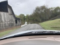
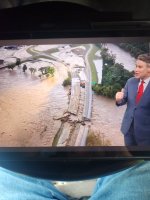
There are a lot of bridges in our county that have been completely washed away and are gone. Here’s one,
There are a lot of bridges in our county that have been completely washed away and are gone. Here’s one,
OverlanderJK
Resident Smartass
We haven’t gotten any rain since midday yesterday. My property is all dried out almost. Ground is wet but no more puddles.Wow! Whats your rain gauge up to?
OverlanderJK
Resident Smartass
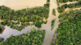
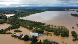
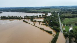
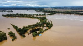
Went and took some pictures with the drone.
The river is the tree line in the top right corner of this picture. There is a road (the road to our place) running right through the middle of this picture.
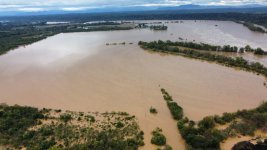
That white roofed building just off center right in this picture is 1/3 of a mile from the river bank to the front door.
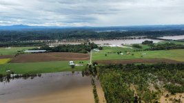
The river is the tree line in the top right corner of this picture. There is a road (the road to our place) running right through the middle of this picture.

That white roofed building just off center right in this picture is 1/3 of a mile from the river bank to the front door.

OverlanderJK
Resident Smartass
OverlanderJK
Resident Smartass
Holy shit dude! Forget the bucket, I think you need one of these...That same bridge is in the middle of this picture
View attachment 414355
I think we are okay where we are at but it is a lot worse than it was 12 hours ago. Two dams up river from have broken.
View attachment 414356View attachment 414357View attachment 414358

OverlanderJK
Resident Smartass
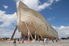
I need a bigger one. That won't hold all the animals. lolHoly shit dude! Forget the bucket, I think you need one of these...
View attachment 414359
Dale72
Hooked
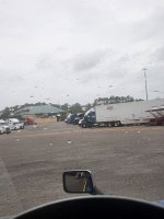
I was in Kingsland GA Thursday night waiting for it to pass before I went down into FL to deliver. I took this about 6pm. Got a lot of rain and wind. The power started going out around 11. It would stay out for a bit then come back on. It went out several times.
Attachments
Dale72
Hooked
I saw a report that they found a couple cracks in the dam on the TN river. They ordered evacuationThat same bridge is in the middle of this picture
View attachment 414355
I think we are okay where we are at but it is a lot worse than it was 12 hours ago. Two dams up river from have broken.
View attachment 414356View attachment 414357View attachment 414358
OverlanderJK
Resident Smartass
Yes, my whole area was under evacuation notice. Within 2 miles of the river and we are 1.5 as the crow flies. Two dams broke already. I’m guessing you are referring to the nolichucky dam, which was a concern but seems to be less of one now. The big issue is water was going around the dams because there is so much. It’s eroding the sides.I saw a report that they found a couple cracks in the dam on the TN river. They ordered evacuation
Dale72
Hooked
Probably was, the report I saw didn't say which one. But I did see the report about the nolichucky dam after I postedYes, my whole area was under evacuation notice. Within 2 miles of the river and we are 1.5 as the crow flies. Two dams broke already. I’m guessing you are referring to the nolichucky dam, which was a concern but seems to be less of one now. The big issue is water was going around the dams because there is so much. It’s eroding the sides.

