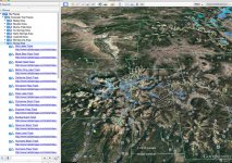
Any interest in Google Earth and trails?

What really bugs me is when other trail users want to come along and close the trails that your group discovered and/or built to"save" them for themselves. This happens too often to the motorcycle community. Hikers and Mt. Bikers( no offense I do both ) get together to close trails that were made by motorcycles generations ago. Same shit happens to jeep trails. Even snow mobile trails. Total bull shit. Ok rant over. Just got me a little fired up.

Pisses me off too. Especially when they're 'protecting' it. Sometimes tax-dollars even get used. Paying for our own destruction....
 
Google Earth + TrailDamage.com is the only way I know. It is fairly tedious - downloading, organizing, etc.. but I tinker with it in spare time.

Here's the monster Alpine Loop on the right, Black Bear on the left-ish.

View attachment 211373

Next to Moab, Telluride is the jeepin holy land. :crazyeyes:

Could you export all your kmz data for me?
 
Uhhhh.....

So i had some time on my hands this morning, and OCD kicked in, and I got sucked into importing just about every single trail damage trail into google earth, sorting by region and including links to the trail so you can easily access the description in google earth. It took more hours than I'm willing to admit. I'll be sharing.....

2016-07-08_11-28-52.jpg

And its awesome....

Here's the KML file... https://www.dropbox.com/s/xhvfjovq1t4z0ks/Colorado Trail Tracks.kml?dl=0

It also is exportable into Gaia GPS for iPhone and I'm sure other ones as well.
 
Last edited:
Uhhhh.....

So i had some time on my hands this morning, and OCD kicked in, and I got sucked into importing just about every single trail damage trail into google earth, sorting by region and including links to the trail so you can easily access the description in google earth. It took more hours than I'm willing to admit. I'll be sharing.....

View attachment 211706

And its awesome....

Ha, I've been pretty much doing the same thing. I'll take yours if you're done with it though. I'm only on "H" of the trails alphabetically.

How are you accounting for difficulty? It'd be nice to filter out trails that are beyond the capabilities of my Jeep.

EDIT: I was naming mine something like "Black Bear 4-6" so I could quickly unchecked anything too difficult without having to go to Traildamage.com

That's not a bad idea, although I don't really add any trails I can't do so I'm not too worried about the rating.
 
LOL!! I know it's a hard concept these days but out here, you have to meet people face to face - get to know them like we used to do prior to the internet and then as "friends", you show each other around. :cool:

Wait... You guys don't so all of your off-roading online?

What a concept!!

:beer:
 
You guys posting trail information are retards.

This is all public shit anyhow. Easily accessible through all of the Charles Wells books and traildamage.com. What's the big deal? What about posting videos of trails? That shows people more about it than any map could and would want to make them go there even more.

The only trails here in Colorado that aren't in the Wells books or on traildamage.com is the real tough stuff: Montrose, Junction trails, the new waterfall trails that the BLM just opened by Glenwood. Die Trying, 21 Road, Topless, Billings Canyon, and the Rangely trails.

Every trail in Colorado (except those just listed) is filled full of all kinds of people all the time. So who gives a shit.
 
I'm still building up my toolbox when it comes to planning trips, trail rides, etc. Right now I'm looking at putting something together in Google Earth. Here is a sample of what it could look like (bonus points if anyone can name this world famous trail):

View attachment 211360

If I put this together, would others be interested in a tool like this? Just trying to gauge interest before I do the work.

can you elaborate on your plans?
 
Haven't decided. Want to heed Eddie's advice and not give info away to yahoo's who will tear up the trails but also want to make trails more easy to find for those who can act responsibly.
 
Haven't decided. Want to heed Eddie's advice and not give info away to yahoo's who will tear up the trails but also want to make trails more easy to find for those who can act responsibly.

Literally downloaded all the data from the internet so I dont see what is different.
 
Maybe it's just a Nevada thing but out here, posting up trails on the internet is typically looked at as being bad form. It's hard enough to keep the douchebags away and ruining it for everyone. If you guys do something, I'd be grateful if you kept the exchange of information PRIVATE or at least, off of WAYALIFE.

Literally downloaded all the data from the internet so I dont see what is different.


Not sure why your having a hard time understanding this H8. It was asked to keep it off the forum. End of discussion beyond that.
 
Top Bottom