THE ROAD LESS TRAVELED - Part 1 : Taking the Stage Route Home

Great road trip. I wish Wayalife would establish a section that follows Roadrunner Magazine format that provide the way points and an area map for different road trips. I do use the Roadrunner Magazine for suggested road trips and have had tons of fun on the different road trips published in the magazine. But meeting offroaders on routes through Wayalife would be outstanding.

Do you work for the magazine who's name you keep mentioning? What was it again?


Sent from my iPhone using WAYALIFE mobile app
 
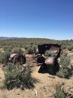
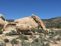
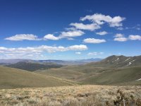
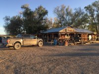
Not wanting to miss out on the action, I followed in Eddie and Cindy's footsteps a few days ago. This time in my buddy's Ford Raptor (don't hate - it's ideal for this terrain). Managed to get through some of the trail and will have to go back for more later. That area of the country is pretty amazing and there's loads of exploring to do. Here's a couple of (familiar) photos.

On the way back to SF we actually saw Rubicat heading East on Hwy 50 - it's a small world out there. Hopefully I'll see some of y'all on the trails some time soon....

2017-05-13 11.15.05.jpg

2017-05-13 11.21.45.jpg

2017-05-13 15.11.03.jpg

2017-05-13 19.25.08.jpg
 
Great road trip. I wish Wayalife would establish a section that follows Roadrunner Magazine format that provide the way points and an area map for different road trips. I do use the Roadrunner Magazine for suggested road trips and have had tons of fun on the different road trips published in the magazine. But meeting offroaders on routes through Wayalife would be outstanding.

I also subscribe to RoadRunner - it's a motorcycle touring magazine. For those who are not familiar with it, they have readers submit great scenic rides in different areas of the country, with sites to see along the way. It's actually a fantastic resource for anyone that is a motorcycle tourist, like me.

AllTrails is a website that you could use as a reference - there are trails and GPX tracks on there for some popular trails. That might be worth a look.

(I think) the reason that the routes and GPS points are not shared is because the beauty of these trips is the desolation. You have to work to get there. The people that do the work are rewarded with the views and the sites. If the routes and GPS coordinates were plastered all over the internet then what used to be a serene, fairly unspoiled trail would become busy, covered in trash and ruts, and the beauty would be lost.

I was able to figure out (most of) the route by using a map and a little research. I'm sure if you wanted to take this trail badly enough you could do the same. However, I'd ask you not to plaster it all over the internet once you have, so that you save it for the few intrepid explorers who can make the effort to find it for themselves.
 
Top Bottom