ROADSIDE AMERICA : Awesome Roadside Stops Along the Way!

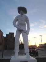
This one is the oldest cowboy in Dodge City, sculpted by a dentist, it was the first public acknowledgement of the cities Wild West past: IMG_0966.JPG got a couple more to check out today or tomorrow.


Sent from my iPad using WAYALIFE mobile app
 
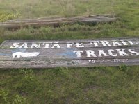
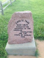
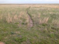
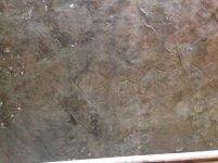
A few miles west of Dodge City is a place where you can park and check out part of the Santa Fe Trail, tracks are mostly gone but you can still see some of the indentions made by the wagons.IMG_0975.jpgIMG_0969.jpgIMG_0971.jpg

This is a path that takes you down into
what was called Soule's Ditch supposed to be a canal that brought water from the Arkansas river into the area for farmers, due to evaporation, flooding, leakage and a busted dam it was never successful. IMG_0972.jpgThis is a path that will take you down to it

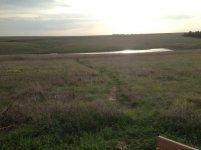
This path takes you farther into the field so you can see other parts of the trail that are mostly visibleIMG_0973.jpg

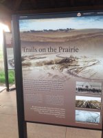
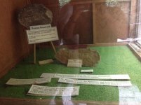
IMG_0971.jpg part of the visitor "center" that explains what you're looking at, not a lot to it but an interesting stop to stretch your legs.


Sent from my iPad using WAYALIFE mobile app
 
Last edited:
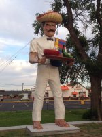
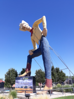
Here we have the La Salsa Muffler Man, he is one of two muffler men that Dennis Hopper had commissioned for an art exhibit. He donated them to the city when he died in 2010. IMG_0984.jpg


Sent from my iPad using WAYALIFE mobile app
 
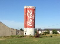
Classic Coke can design painted on a silo, there also used to be a Coors beer can silo that got taken down for highway construction.IMG_1001.jpg.

Found this in Emporia Kansas.


Sent from my iPad using WAYALIFE mobile app
 
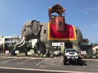
Lucy the elephant in Margate City, NJ which was used originally to show off land when the town was being built. It was then a house at one point, a bar, and is now a tourist attraction where you can take a tour. I forget where but she has a sister which I think is smaller.

IMG_9356.jpg


Sent from my iPhone using WAYALIFE mobile app
 
Lucy the elephant in Margate City, NJ which was used originally to show off land when the town was being built. It was then a house at one point, a bar, and is now a tourist attraction where you can take a tour. I forget where but she has a sister which I think is smaller.

OUTSTANDING BUMP to this great thread! :thumb:

I see that there have been a lot of other posts I need to catch up on too :crazyeyes:
 
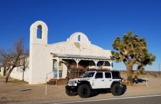
The Kill Bill Church

Lots of movies and commercials have been filmed in the Antelope Valley.

Here's a pic of the Kill Bill Church...

20181228_153531.jpg
 
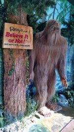
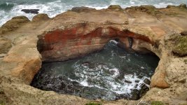
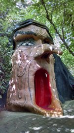
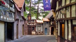
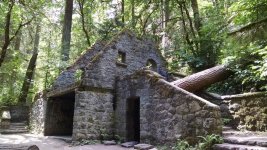
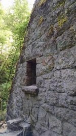
Forgot about this thread...Ripley's in Newport, The Devils Punch Bowl...funny thing there is a Mo's a few feet away in a shack that is open in the summer, Enchanted Forest near Salem, and The Witch's Castle near Portland.
IMG_20181104_110832005_HDR.jpg

IMG_20181103_110604017_HDR.jpg

IMG_20180706_102322842_HDR.jpg

IMG_20180706_105413851_HDR.jpg

IMG_20180706_145432414.jpg

IMG_20180706_145807540.jpg
 
Thread revival!!! lol Iv been wanting to bring this thread back for a while now. Especially since everyone is starting to travel again… lll start and even though it’s not too much of a road side attraction.
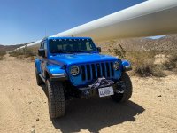
Here’s Bullwinkle next to the California aqueduct.
 

Attachments

  • C1D184C8-9619-4A2A-B177-4F8D55944744.jpeg
    C1D184C8-9619-4A2A-B177-4F8D55944744.jpeg
    274.5 KB · Views: 16
Thread revival!!! lol Iv been wanting to bring this thread back for a while now. Especially since everyone is starting to travel again… lll start and even though it’s not too much of a road side attraction.
Here’s Bullwinkle next to the California aqueduct.
That’s a great name for a nice looking JT! What’s the story behind the name?
 
A few miles west of Dodge City is a place where you can park and check out part of the Santa Fe Trail, tracks are mostly gone but you can still see some of the indentions made by the wagons.View attachment 259462View attachment 259463View attachment 259464

This is a path that takes you down into
what was called Soule's Ditch supposed to be a canal that brought water from the Arkansas river into the area for farmers, due to evaporation, flooding, leakage and a busted dam it was never successful. View attachment 259468This is a path that will take you down to it

This path takes you farther into the field so you can see other parts of the trail that are mostly visibleView attachment 259467

View attachment 259464 part of the visitor "center" that explains what you're looking at, not a lot to it but an interesting stop to stretch your legs.


Sent from my iPad using WAYALIFE mobile app
This is cool. I've been to the roadside markers and seen them. But, the coolest thing is flying over in a small airplane. Especially in the late summer/fall. You can see miles of trail. Across land off limits, and highlighted in the late summer sun. Truly wonderful.
 
Top Bottom