You are using an out of date browser. It may not display this or other websites correctly.
You should upgrade or use an alternative browser.
You should upgrade or use an alternative browser.
JEEP TRAIL OFFROAD GPS: What GPS is everyone running?
- Thread starter JandSJK
- Start date
black pearl
Hooked
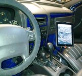
Just hooked up the ipad mount with BadElf receiver and Gaia maps. Downloaded some satellite maps already and love it. It's exactly what I was hoping for. Very happy with it.
View attachment 262422
I was looking at the Gaia maps is that a payed app? Only asking because it had a 7 day free trial
I pulled the trigger on the garmin after looking at them it's a great little gps just need to get more maps for it now
Sent from my iPhone using WAYALIFE mobile app
WJCO
Meme King
I was looking at the Gaia maps is that a payed app? Only asking because it had a 7 day free trial
I pulled the trigger on the garmin after looking at them it's a great little gps just need to get more maps for it now
Sent from my iPhone using WAYALIFE mobile app
Did you get the eTrex 20? If so, Garmin Basecamp with BirdsEye view is what I use on that one. I think it's 30 bucks a year. I've downloaded all I need so I let it expire. The Gaia maps I think were 10 bucks a year, but make sure they will work with your new GPS. I tried the free trial with Gaia but couldn't use all the functions so I just went ahead and bought the subscription.
jtpedersen
Caught the Bug
Garmin 590LM
I've been using Garmin for 11 years now. Currently I'm using the 590LM. If you have a Garmin unit already, they have a great upgrade program for existing owners. If the Sales team doesn't have your model on their list, contact Support--they have a longer (older) list. In my case, I was able to buy a $800 unit for under $500.
The 590 is water resistant and designed as a dual-use for motorcycles and in-vehicle. In the Jeep, I mount it directly above the in-dash GPS. Works well at off-road. I also download/install custom maps for off road use. One of the things I like is the ability to download the track history, study elevation changes, and export to Google Maps or Earth if desired.
The ability to track my route is useful. Combined with Basecamp, doing so lets me create routes for future use. There's a wide range of other features I use as well; of value to the beholder.
While pricey, you get what you pay for with these things. For me, the feature set, water resistance, expandable memory, swappable battery, and app/feature set are worth it. Should last me for 10 years.
black pearl
Hooked
Did you get the eTrex 20? If so, Garmin Basecamp with BirdsEye view is what I use on that one. I think it's 30 bucks a year. I've downloaded all I need so I let it expire. The Gaia maps I think were 10 bucks a year, but make sure they will work with your new GPS. I tried the free trial with Gaia but couldn't use all the functions so I just went ahead and bought the subscription.
Yeah I got the etrex 20x it should fit my need for quite a while. sounds like I'm going to need access to a computer to put maps on it. You think a place like REI could load the maps I want for me?
Sent from my iPhone using WAYALIFE mobile app
WJCO
Meme King
Yeah I got the etrex 20x it should fit my need for quite a while. sounds like I'm going to need access to a computer to put maps on it. You think a place like REI could load the maps I want for me?
Sent from my iPhone using WAYALIFE mobile app
You have to download Basecamp onto a designated computer. Then plug your GPS into that to get the maps on the device. BirdsEye imaging is the best way to do that with the eTrex20. Here's a link to Basecamp just so you can see how it works. It offers a lot: http://www.garmin.com/en-US/shop/downloads/basecamp
black pearl
Hooked
You have to download Basecamp onto a designated computer. Then plug your GPS into that to get the maps on the device. BirdsEye imaging is the best way to do that with the eTrex20. Here's a link to Basecamp just so you can see how it works. It offers a lot: http://www.garmin.com/en-US/shop/downloads/basecamp
Awesome thanks ... now to find a friend that will let me use a computer [emoji23][emoji23]
Sent from my iPhone using WAYALIFE mobile app
WJCO
Meme King
Awesome thanks ... now to find a friend that will let me use a computer [emoji23][emoji23]
Sent from my iPhone using WAYALIFE mobile app
You can get them cheap nowadays. Used laptop on CL or ebay.
black pearl
Hooked
You can get them cheap nowadays. Used laptop on CL or ebay.
Yeah I should just finely give in and buy one ... it wouldn't hurt to have
Sent from my iPhone using WAYALIFE mobile app
aftermarket radios and gps
So I am looking for anew jeep and can't find exactly what I want so I am trying to decide what aftermarket option is best. I am looking at radios I want the 430n but the right jeep doesn't have it. I like the 430 n because I have one now and was able to put a loc pic on it. this means I have hooked up 2front and 1 rear cameras and a lot of other cool stuff.. I have downloaded 200 songs to it and run audio book through the hookup
The radio that comes up the most is the alpine 900r or something like that. My question is for those of you who have gone aftermarket what did you do? why.
and for folks that have the alpine
Does it r any of the aftermarket have hard drives that you could down load music to?
How does it work? Can you run your phone through it?
Could you down load a mapping app like Gaia Topo USA and topo graphic maps to? In dash off road GPS would be awesome.
I really want it odd everything the 430 n does and just as seamlessly . What do you guys recommend?
Any idea I am welcome to them. Thanks
Gps??
I’m looking for a new head unit for my 2011 rubicon so that has me thinking about what would be the best GPS system that won’t leave me lost on trails with no service! Any suggestions?
Sent from my iPhone using WAYALIFE mobile app
I’m looking for a new head unit for my 2011 rubicon so that has me thinking about what would be the best GPS system that won’t leave me lost on trails with no service! Any suggestions?

Sent from my iPhone using WAYALIFE mobile app
aTX427
New member
GraniteCrystal
New member
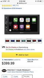
I went with this unit in my wife’s 15 and I’m considering it in mine as well. It uses apple maps or google maps. The car play or android equivalent is great and saves $ versus buying a full gps head unit. It also can use the dm radio app so I’m sure other gos apps can be used with this head unit.
Sent from my iPhone using WAYALIFE mobile app

Sent from my iPhone using WAYALIFE mobile app
DR DPE
Member
Arrcherr
Caught the Bug
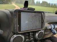
I actually downloaded that app a few days ago but have yet to set up an account. Does it contain known trail info or does it just have the ability to track you when off road?I have been using Gaia Gps
app on a mini ipad . Works pretty good
BaddestCross
Active Member
They have some crowd-sourced trails online, but hit and miss. You can import GPS tracks into it from FunTreks (for example), though.I actually downloaded that app a few days ago but have yet to set up an account. Does it contain known trail info or does it just have the ability to track you when off road?
The paid version allows for several different map layers that are helpful. I've used it a few times and like it.
--
Build Thread - Adventures of Fiona - https://wayalife.com/showthread.php?t=47407


