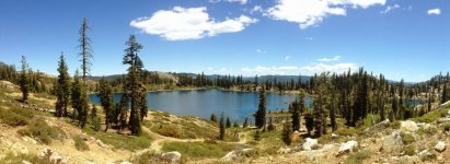
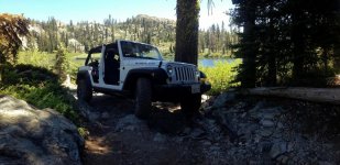
Gold Rush Run 2012 - Part 1: Snake Lake & Poker Flat

Great write up, I have done some exploring in this area but plan to spend a lot more time up there this summer. Couple questions if you don't mind.

Any good undeveloped camping spots up past the Gold Lake campground? Would a stock JKUR be OK making it up to Snake Lake? Also, I know there are a ton of different trails back off that section, any others you would recommend?
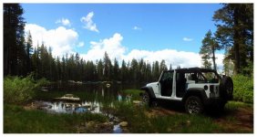

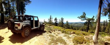
Yeah, there are definitely some good trails up around Snake Lake and, so long as you don't try climbing the big hill (do the trail in reverse to the lake), you should be fine. Other nice trails in the immediate area would include Deer Lake and Sierra Buttes.
 
Growing up in Sacramento and having family in Downieville I must say I have not been there but want to go. If you get a chance check out Iron Mountain near Grizzly Flats in Eldorado County.

Great pics

Will
 
It is my go to place for camping and wheeling as I live fairly close and have been up and down the trail . I have not seen a place that I would call a camp site .There are camp sites around Gold lake and my favorite is the 4 wheel camp site .It can be busy though sometimes .
 
Yeah, that's the reason I ask. Been to the gold lake ohv site and it is busy. I'm usually stuck to weekends :/
 
AHHHHH i hate living in the midwest there isnt anything scenic here... i want to move sooooo bad

love the pics Eddie and Cindy you two live the dream...:thumb:
 
Made it up to this area again a couple weekends ago, had a great time. A few pics...

The first evening after driving up did the short trail up to Squaw Lake. This spurs off the Gold Lake OHV trial just a half mile in or so. Climbs uphill with a lot of loose rock, but nothing too crazy.

ImageUploadedByWAYALIFE1371827979.599570.jpg

The second day we took the trail to Deer Lake. We started from the Gold Lake trail head. You pass the OHV campsite up to Summit Lake and then turn South. You climb up above 7,000 feet and then follow the ridge which gives the amazing views.

ImageUploadedByWAYALIFE1371853951.144966.jpg

Looking down to Deer Lake. There is a short (but steep!) trail down to a parking area and then you must hike down to the actual shoreline.

Deer Lake.jpg

The last day we headed up to Snake Lake. Wayoflife covered this one in his post. Fun trail and a great test for a stock Rubicon. Used the sliders and skids some but it did great. Doing it counter clockwise puts the toughest stuff downhill. Going the otherway, I think climbing the main hill would put a lot of rigs to the test. Of course I didn't get any pics of the tough stuff since my ass was suction cupped to my seat :eek:

Snake Lake.jpg

Good times! :beer:
 
About an hour north of Lake Tahoe and deep into the Sierra Nevada Mountains, the northern most stretch of Highway 49, also known as the Mother Lode, crosses through an area containing more than 45 glacier carved lakes, and because of it, has been given the name, Lakes Basin. Crowned with an ancient volcanic peak known as the Sierra Buttes, this area was once buzzing with activity and populated with thousands of miners trying to strike it rich. Of course today, about the only thing buzzing around are mosquitos. Thanks to its remote location and being in a county that has one of the lowest populations in the state, the Lakes Basin is a perfect place to get away from it all and explore California's rich history in a way that might have resembled what it was like over 150 years ago.
Hi Eddie pm me about this pick please

Sent from my SM-T377V using WAYALIFE mobile app
 
Great trip in the old mining area. Thanks Eddie and Cindy for the photo posts and log, that area goes on the list to check out.
 
Top Bottom