CONCRETE ARROW QUEST : Search for Transcontinental Airway Beacons

Yeah we never crash, we may make a forced or off field landing but never crash ;) They had a ton of skill and were a little crazy but, definitely weren't the insane cowboys of the movies.

The definition of crash is subjective like I wheel hard, Bell Helicopter's theory is if it can be repaired and flown again it's considered a hard landing not a crash. Those guys had balls.


Sent from my iPad using WAYALIFE mobile app
 
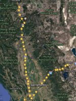
Sitting around bored. Found a list of the Airway beacons and mapped out what is known of the two routes in Northern California..
AIRWAY BEACONS CA.jpg
The top beacon near the Oregon border is Montague and to the east is Verdi
 
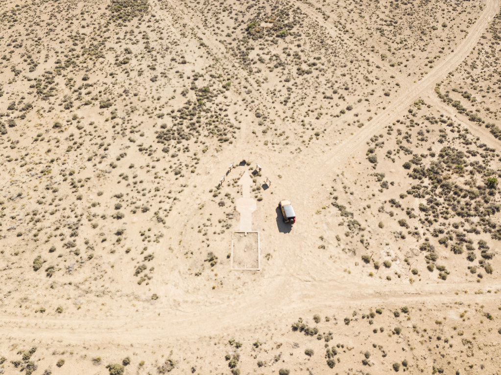
Figured I'd contribute to this thread finally, after all the inspiring hunting going around... I'll post up a separate thread of my current western jeep trip, but here are two arrows from my travels....

This one was in Wyoming, sorry for the slightly out of focus shot, my mavic was in manual focus mode and I didn't notice until way later in the hotel

36707247051_a65cfdf8ef_b.jpg


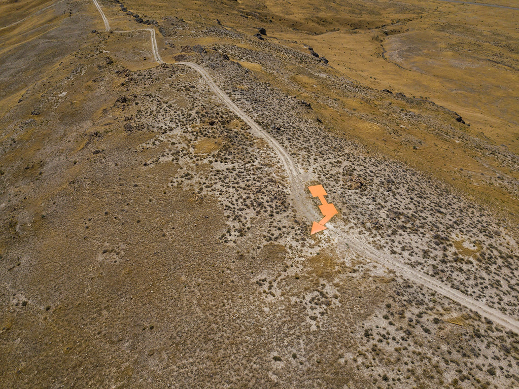
This one is from Utah on my way to the Bonneville Salt Flats

This one seemed to have a fresh coat of neon orange paint.....wonder if it's for visual aid, and if they are still in use.

36037519123_e64b138dd8_b.jpg
 
Last edited:
Very interesting. 1 in Nebraska, 5 in Kansas. Going to try and find the one in Nebraska next time I'm on my way to Colorado, as it's on that part of the state. Thanks for sharing.
 
How do you find the ones in your state? I have done a quick Google and have found a couple sites in Arizona (no concrete arrows), but I am wondering if there is a place to find the old air routes to follow.

Sent from my SM-G900V using WAYALIFE mobile app
 
Figured I'd contribute to this thread finally, after all the inspiring hunting going around... I'll post up a separate thread of my current western jeep trip, but here are two arrows from my travels....

This one was in Wyoming, sorry for the slightly out of focus shot, my mavic was in manual focus mode and I didn't notice until way later in the hotel

This one is from Utah on my way to the Bonneville Salt Flats

This one seemed to have a fresh coat of neon orange paint.....wonder if it's for visual aid, and if they are still in use.

Awesome finds and great shots! Thanks for posting these up :thumb:
 
Figured I'd contribute to this thread finally, after all the inspiring hunting going around... I'll post up a separate thread of my current western jeep trip, but here are two arrows from my travels....

This one was in Wyoming, sorry for the slightly out of focus shot, my mavic was in manual focus mode and I didn't notice until way later in the hotel

36707247051_a65cfdf8ef_b.jpg


This one is from Utah on my way to the Bonneville Salt Flats

This one seemed to have a fresh coat of neon orange paint.....wonder if it's for visual aid, and if they are still in use.

36037519123_e64b138dd8_b.jpg

Not sure how I missed this, but great find! It would appear that they must use the neon one for something still if it looks that fresh
 
Not sure how I missed this, but great find! It would appear that they must use the neon one for something still if it looks that fresh

Yup, this one was NOT easy to get to and it was in the middle of nowhere, so somebody definitely purposefully painted it....unless they do it for landmark purposes. :thinking:
 
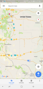
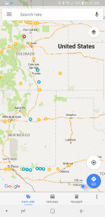
With the official Texas Exodus trip ending last Thursday the misses and I spent another 9 days doing our own thing in Colorado. We attempted Wyoming but decided against it after one of the roads from Estes Park going East was closed and would have added a fair amount of time to detour. I wanted to take the long way to Houston via El Paso from northern Colorado due to the many beacons along the route. Each yellow marker is a beacon and the blue ones are the ones we made it to or at least attempted.

attachment.php


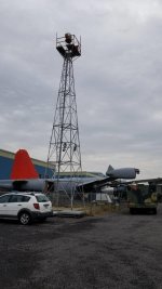
First one was in Pueblo, CO at their air port. All that remains is the beacon tower. Not much to see so we left without really stopping.

attachment.php


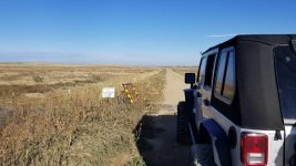
The next one was south of there. The most direct route took us on a dirt road for about 20 miles until we came upon a gate for private property. I waited for a bit to see if anyone would show up so I could ask permission however nobody did.

attachment.php


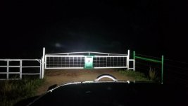
The next one was a few hours south into NM. South of Las Vegas. It was 430ish by this time and I knew it was gonna be dark when we got there but we tried anyway. After driving on a muddy county road for a while we came to another gate quite a distance to the arrow so we turned around.

attachment.php


We then stayed in Albuquerque that night.

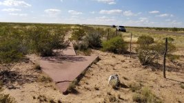
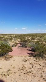
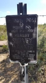
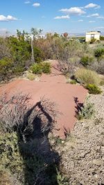
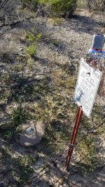
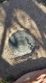
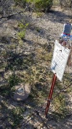
Next stop was east of El Paso. Being on somewhat of a clock to get back home with a day to relax before work Monday we attempted ones that looked like we could get to going off the map. First one we didn't attempt due to this. Second beacon was literally right off the highway which was easy to find and was the first actual arrow located. The survey sign was intact as well however couldn't find the monument.

attachment.php


attachment.php


attachment.php


Next one was about 12 miles east, north of the road. We drove on some dirt roads that seemed like private property but we didn't see signage nor opened gates or anything like that so we continued. Not that we saw any signs of active life anyway. Just run down houses and cars. After driving for a while we ran into a corner of fences and gates. Not wanting to upset a west Texan that could easily dispose of my corpse we turned around before my dumbass decided to hop barbed wire fences. No pictures.

Next one was about 15 miles east. This was was behind the Salt Flat Cafe. It was close to the cafe but also there were some homes. I pulled onto their property and people were outside. I told the first guy what I was doing and asked permission. He had no issues without and went over to an elderly couple and, in a family ribbing joking way, yelled at, I assume his mother, to show me around since apparently she knew all about it. And boy did she.

She was born there in the late 20s. The beacon and even an air strip was installed in the 30s. She remembered it well. She also recalled paratroopers doing their training and so forth on on that property during the war in the 40s. The air strip and all was decommissioned in the 80s however the arrow and survey marker are all intact. They have hundred of acres in west Texas where all her family lives. She says she occasionally gets people like me looking for these things and enjoys telling her story. I didn't get any pics of the cafe or jeep since it was parked a fair distance and honestly I was just distracted by her history lesson. Plus I didn't want to take up their time with a photo shoot.

attachment.php


attachment.php


attachment.php


She told me about Jeff Bezos' property in Van Horn( CEO of Amazon). Didn't know he had property out here. Apparently his other company, Blue Orgin, has a suborbital launch site in the mountains along with a residence of his. An arrow or two are on that mountain top so obviously we didn't even attempt it. The two east of Pine Springs are believed to be on his property.

View attachment 278818


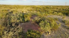
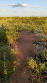
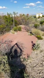
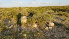
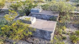
After that we headed towards Orla. There was one a little bit off the road. There is a ton of drilling for oil and gas in west Texas. This beacon was on the property of a company but the gate was open and there weren't any no trespassing signs despite it is off a county road. We came upon a cattle gate which was closed. I didn't want to deal with it so we parked and I hopped the gate. This was the best-intact one yet.
20171006_190305%7E2.jpg
20171006_190316%7E2.jpg
20171006_190326%7E2.jpg
20171006_190350%7E2.jpg

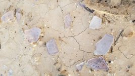
About 50 feet away was clearing. There was some rubbish and other junk. Closest to the arrow was a pile of broken glass which appeared to be a Fresnel lens. At least nothing else came to mind.
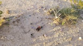
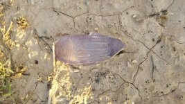
20171006_191018%7E2.jpg
20171006_191024%7E2.jpg
20171006_191036%7E2.jpg
20171006_191611%7E2.jpg

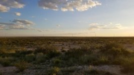
That would end up being our last one due to dusk, needing gas and just needing to keep going. I still plan on attempting the other ones however it may be a a year or two before I can since it is a full days drive from Houston.
 
Last edited:
My phone crashed while typing thus some of the pictures were "lost". Below are them in order starting with a map.

Screenshot_20171007-111759%7E5.png
20171005_141440%7E3.jpg
20171005_161335%7E3.jpg
20171005_193149%7E3.jpg
20171006_162020%7E3.jpg
20171006_161910%7E3.jpg
20171006_162330%7E3.jpg
20171006_173135%7E3.jpg
20171006_173534%7E3.jpg
20171006_173551%7E3.jpg
 
Okay, I see there are 4 more pics that are missing but wasn't sure if the last 3 you uploaded were the ones that go there. If so, there's still one missing.
 
20171006_173135%7E2.jpg20171006_173534%7E2.jpg20171006_173551%7E2.jpg

Well the one screenshot of the West Texas Suborbital launch station won't load. It was to reference the two beacons believed to be on his property.

Thanks for editing my post with these pictures, however. I appreciate it.
 
Well the one screenshot of the West Texas Suborbital launch station won't load. It was to reference the two beacons believed to be on his property.

Thanks for editing my post with these pictures, however. I appreciate it.

Okay, I added the 3 pics to your original thread. The last one could just be too big in size. If you could resize it just a bit so that the MB size is smaller, that might do the trick.
 
Okay, I added the 3 pics to your original thread. The last one could just be too big in size. If you could resize it just a bit so that the MB size is smaller, that might do the trick.
Yea that's what it is telling me. I'll work on it.
 
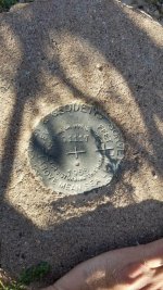
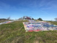
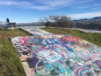
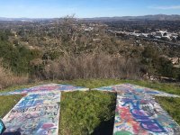
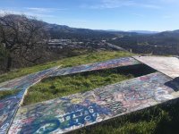
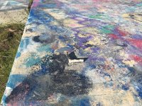
Tina and I went for a hike today to an airway beacon close to home. You could still see some of the metal brackets from the tower but it was covered in graffiti because it is so accessible. Anyway here are a few pics.

IMG_6968.jpg
IMG_6969.jpg
IMG_6970.jpg
IMG_6974.jpg
IMG_6973.jpg


Sent from my iPhone using WAYALIFE mobile app
 
Tina and I went for a hike today to an airway beacon close to home. You could still see some of the metal brackets from the tower but it was covered in graffiti because it is so accessible. Anyway here are a few pics.

View attachment 318177
View attachment 318178
View attachment 318179
View attachment 318180
View attachment 318181


Sent from my iPhone using WAYALIFE mobile app

Those are pretty cool (minus the vandelism of course)... I keep meaning to throw that search into one of my trips


Sent from my iPhone using WAYALIFE mobile app
 
Top Bottom