longarmwj
New member
Dawson Forest. For locals here in Northern Georgia those two words stir up a whirlwind of rumors and theories, everything from haunting to demonic activities, to mutated animals. While I've never seen any spirits and have for sure never seen any two headed deer, there is a bit of mystery surrounding this place. But the real question is, what exactly is Dawson Forest? For starters, Dawson Forest is a 10,130-acre public-use forest located in Dawson County, Georgia. It is owned by the city of Atlanta, but is considered a state forest, as it is managed by the Georgia Forestry Commission.
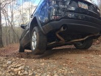
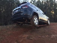
It's only been that way since 1971 though, when it was purchased from Lockheed. The original use? A nuclear aircraft laboratory, also known as Air Force Plant 67 (AFP67). It was used to investigate the feasibility of a nuclear powered aircraft. The site was used to irradiate military equipment as well as the surrounding forest to try to study the effects of a possible nuclear war on the environment and the wildlife. What went on here is highly classified, and almost no documentation of it exist, and they took many precautions to make sure that any future adventurers weren't able to enter the remains. They went as far as burying some buildings entrances, and blocking off roads that went to certain places, however most remains are still very easy to find. I decided to take my day off work and climb in the WK2 and go explore.
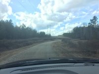
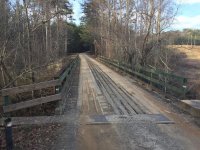
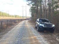
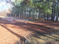
This is the main road that enters AFP67. This road runs adjacent to a few concrete slabs that took some research to figure out what was there.
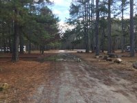
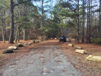
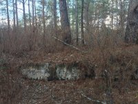
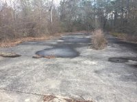
Off to one side is what is believed to be a hanger where they disassembled planes and other equipment to prepare them for testing. This theory is heavily fortified because in the concrete slab are obvious mounts for what look to be very heavy duty lifting systems, as well as some remaining hookup points for what could be an air compressor or other tool system. Also there is the obvious remains of a loading platform and steps into the building, as well as the remains of the exterior wall foundation.
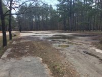
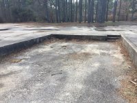
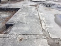
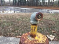
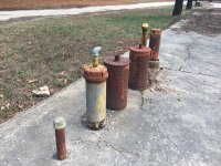
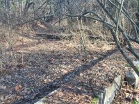
On the other side is what is believed to be a garage where military vehicles were stored. This theory is further reinforced by obvious entry ramps.
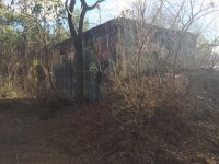
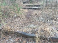
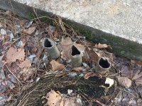
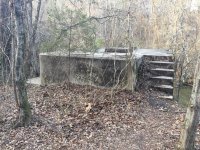
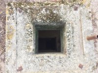
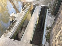
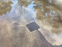
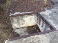
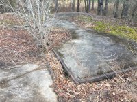
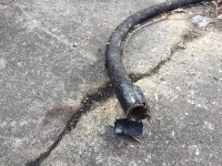
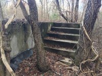
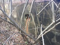
Further behind the supposed storage building is another structure. And this one has me scratching my head. There's a very steep ramp on one side, but on the other side there are stairs that would have gone to an entry, with a few very obvious tracks where it appears sliding partitions were mounted. On the other side there appears to be some cut out for another loading dock type of contraption. What's more puzzling is the fact that there was an exposed gas or water line. Makes you wonder what this structure was used for, especially since I've been able to find zero information about it. What's even more strange is on one of the outside walls there seems to be a window, or some kind of vent. It's not a result of vandals because it's too perfectly square. It's something that was built into the structure.
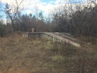
The metal tracks that appear to be for sliding partitions
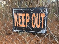
Further back, it was obvious that the state didn't want people exploring too close these buildings. Mostly because they were surrounded by two layers of barbed wire fence, and had multiple signs warning you to keep out. These next few buildings are super interesting though.
First off, there's an underground bunker. When you're dealing with radiation and a nuclear reactor, the threat of a meltdown is real. This was designed to be a place for the people working here to flee to in the event that an explosion or radiation leak was imminent. I find it ironic that it has windows, because that kind of defeats the purpose.
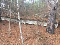
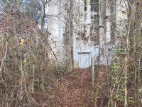
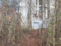
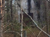
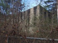
The building directly behind it is the actual laboratory. Because they were dealing with nuclear substance here, there are absolutely zero windows on it. I couldn't get close to it to get any good pictures but I was able to stick my camera through the fence most places and get the best I could. Most of this lab is underground, and it extends about 10 stories beneath the surface. And shockingly it extends almost a mile in diameter, but more on that later.
Sent from my iPhone using WAYALIFE mobile app
It's only been that way since 1971 though, when it was purchased from Lockheed. The original use? A nuclear aircraft laboratory, also known as Air Force Plant 67 (AFP67). It was used to investigate the feasibility of a nuclear powered aircraft. The site was used to irradiate military equipment as well as the surrounding forest to try to study the effects of a possible nuclear war on the environment and the wildlife. What went on here is highly classified, and almost no documentation of it exist, and they took many precautions to make sure that any future adventurers weren't able to enter the remains. They went as far as burying some buildings entrances, and blocking off roads that went to certain places, however most remains are still very easy to find. I decided to take my day off work and climb in the WK2 and go explore.
This is the main road that enters AFP67. This road runs adjacent to a few concrete slabs that took some research to figure out what was there.


Off to one side is what is believed to be a hanger where they disassembled planes and other equipment to prepare them for testing. This theory is heavily fortified because in the concrete slab are obvious mounts for what look to be very heavy duty lifting systems, as well as some remaining hookup points for what could be an air compressor or other tool system. Also there is the obvious remains of a loading platform and steps into the building, as well as the remains of the exterior wall foundation.


On the other side is what is believed to be a garage where military vehicles were stored. This theory is further reinforced by obvious entry ramps.

Further behind the supposed storage building is another structure. And this one has me scratching my head. There's a very steep ramp on one side, but on the other side there are stairs that would have gone to an entry, with a few very obvious tracks where it appears sliding partitions were mounted. On the other side there appears to be some cut out for another loading dock type of contraption. What's more puzzling is the fact that there was an exposed gas or water line. Makes you wonder what this structure was used for, especially since I've been able to find zero information about it. What's even more strange is on one of the outside walls there seems to be a window, or some kind of vent. It's not a result of vandals because it's too perfectly square. It's something that was built into the structure.


The metal tracks that appear to be for sliding partitions


Further back, it was obvious that the state didn't want people exploring too close these buildings. Mostly because they were surrounded by two layers of barbed wire fence, and had multiple signs warning you to keep out. These next few buildings are super interesting though.

First off, there's an underground bunker. When you're dealing with radiation and a nuclear reactor, the threat of a meltdown is real. This was designed to be a place for the people working here to flee to in the event that an explosion or radiation leak was imminent. I find it ironic that it has windows, because that kind of defeats the purpose.

The building directly behind it is the actual laboratory. Because they were dealing with nuclear substance here, there are absolutely zero windows on it. I couldn't get close to it to get any good pictures but I was able to stick my camera through the fence most places and get the best I could. Most of this lab is underground, and it extends about 10 stories beneath the surface. And shockingly it extends almost a mile in diameter, but more on that later.

Sent from my iPhone using WAYALIFE mobile app
Attachments
Last edited:

